GIS Data Analysis
What does Data analysis entail?
This is the process of deriving information from one or more layers of spatial data.
Layers refer to different sets of data collected about one or more subject(s) of interest that would then be represented on a map or graphic.
Data can be derived from various sources such as:
Spatial Measurements
Distance between two points, the area of a polygon or the length of a line or boundary.
Information Retrieval
This answers the question “What is where?” through data retrieval from the corresponding database.
Spatial Overlay
This is accomplished by joining and viewing together separate datasets that share all or part of the same area. The result of this combination is a new data set that identifies the spatial relationships.
Boundary Analysis
This is often referred to as districting and helps define areas according to certain criteria.
Other GIS Functions
Buffer analysis, Neighborhood Functions, Connectivty analysis etc. amongst other functions can also be used to acquire the results that you may need.
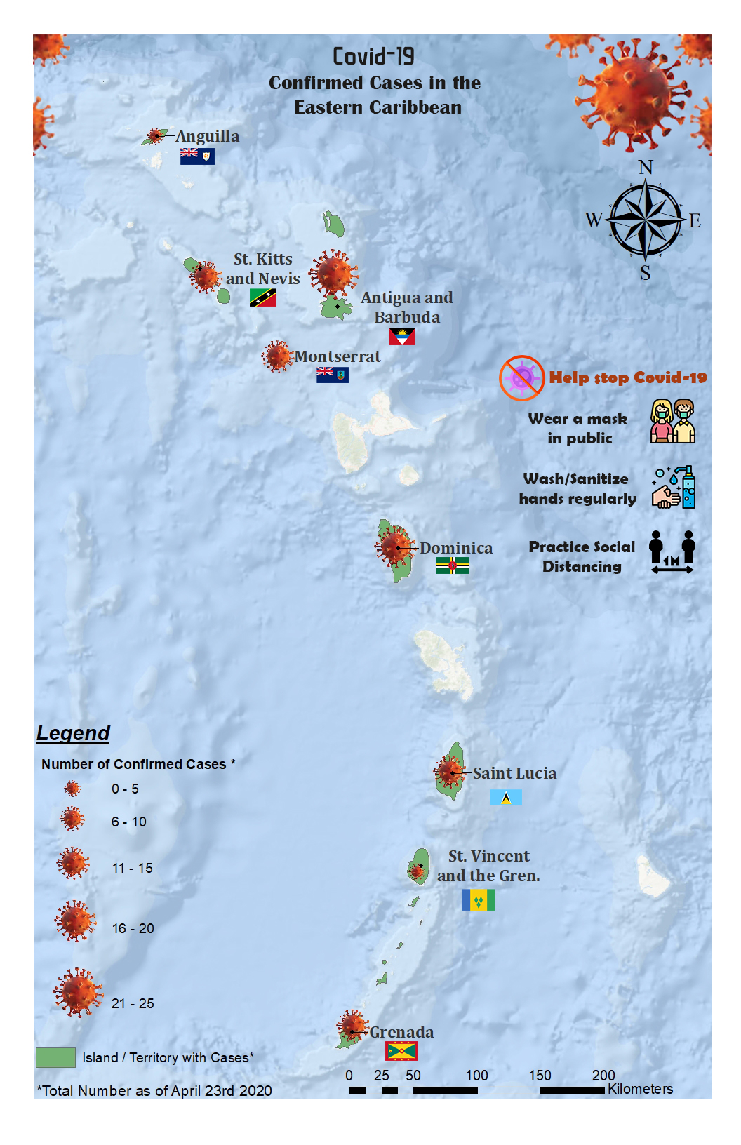
Map Products
Get great design and function together in one map
Let us tell the story for you using a combination of datasets and analytical techniques. We can bring your data to life!
Maps can be created for presentations, posters, SBA’s, Theses, Final Projects etc. using any theme of your choosing.
Existing data can be incorporated and additional data can be collected for you if necessary. Just give us your vision and we will make it a reality.